History · Kiribati
Kiribati: Atolls on the Equator
Thirty-three low islands scattered across an ocean the size of the continental United States — a navigator society, a strip-mined phosphate island, one of the bloodiest battles of the Pacific War, and a front line of sea-level rise
By Worldlore Editorial · 19 September 2026
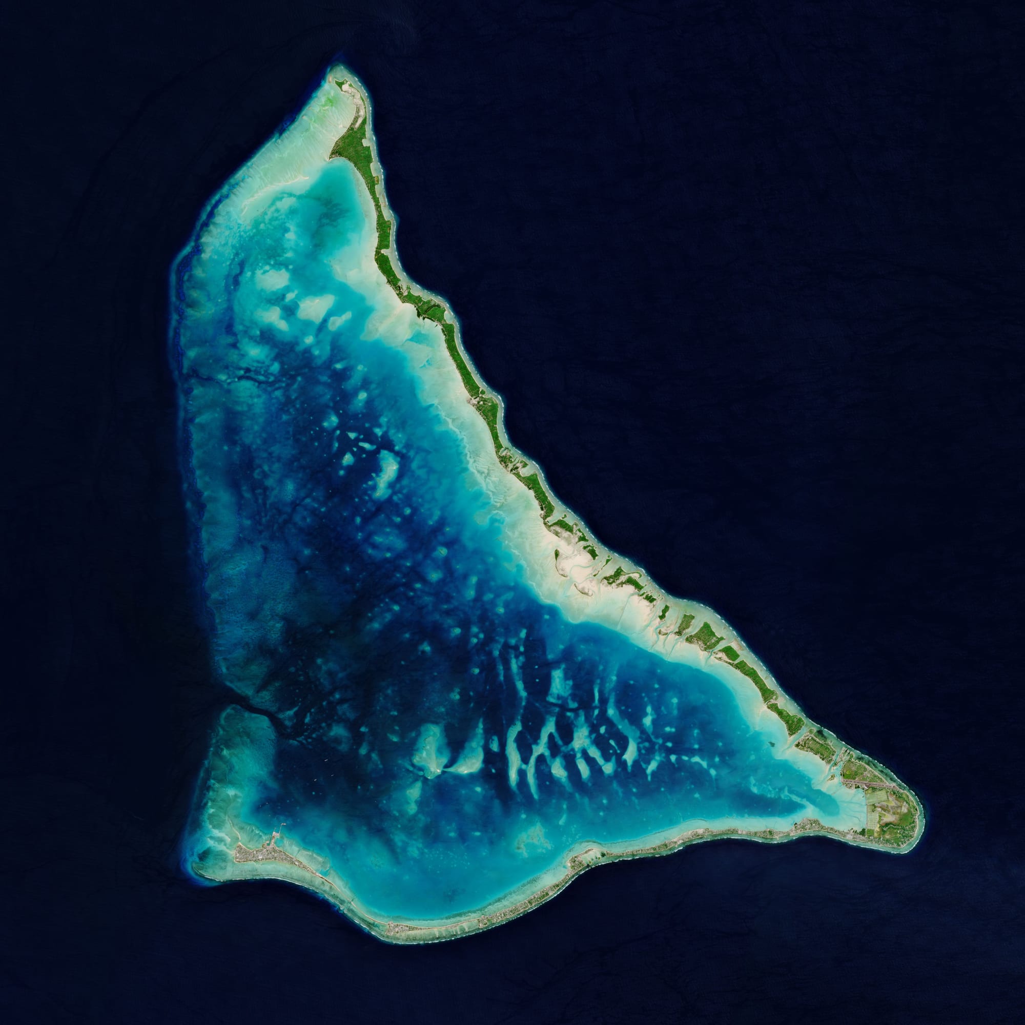
A country that is almost all sea
Kiribati straddles the Equator and the International Date Line in the central Pacific — 33 atolls and reef islands in three widely separated groups, plus the raised island of Banaba. It is the only country in all four hemispheres, and the place where each new day on Earth begins. About 130,000 people live there, most of them crowded onto South Tarawa. Its history is one of isolation, of a phosphate island consumed for other countries' farms, and, now, of a low country facing a rising ocean.
A short history
- c. 1000 BCE onward
Settlement
Micronesian voyagers reach the Gilbert Islands.
- 1788
The Gilberts
Named for a British sea captain.
- 1820s–1870s
Traders and blackbirders
Whalers, labour recruiters and missionaries arrive.
- 1892
Protectorate
Britain takes the Gilbert and Ellice Islands.
- 1900
Banaba phosphate
Discovered, and strip-mined for 80 years.
- 1943
The Battle of Tarawa
One of the Pacific War's bloodiest assaults for its size.
- 1957–1962
Nuclear tests
Britain and the US test bombs at Kiritimati.
- 1979
Independence
Kiribati becomes a republic as phosphate runs out.
The navigator islands
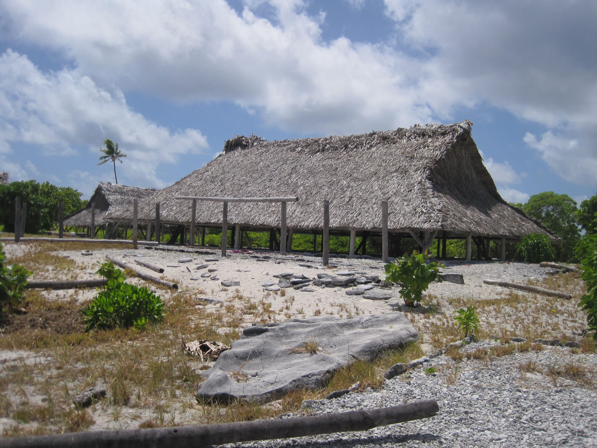
Micronesian voyagers settled the Gilbert Islands around three thousand years ago, with later Polynesian influence and Fijian raids shaping the I-Kiribati people. It was a society of skilled navigators and canoe-builders and fearsome warriors, with no overarching state — each island largely governed itself through its council and its maneaba, the great meeting house at the centre of community life.
Whalers came in the 1820s, followed by labour recruiters — including Peruvian slave raiders in the 1860s that devastated some islands — traders in coconut oil and copra, and missionaries who converted the islands almost completely. Britain declared a protectorate over the Gilbert and Ellice Islands in 1892, partly to control the labour trade.
Banaba
In 1900 phosphate rock — fossilised seabird guano — was found on Banaba. For 80 years, a British-Australian-New Zealand mining body strip-mined the island to supply cheap fertiliser to Australian and New Zealand farms, destroying about 90 per cent of its surface.
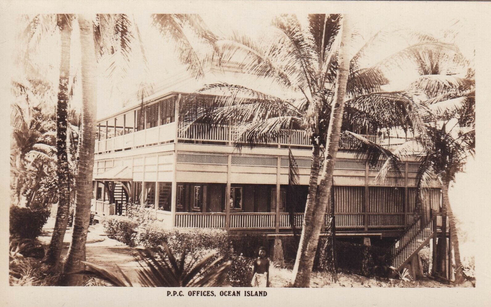
The Banabans later sued the British Crown in London over the mining. They largely lost on legal points but won a measure of moral vindication and an ex gratia payment.
War, and bombs
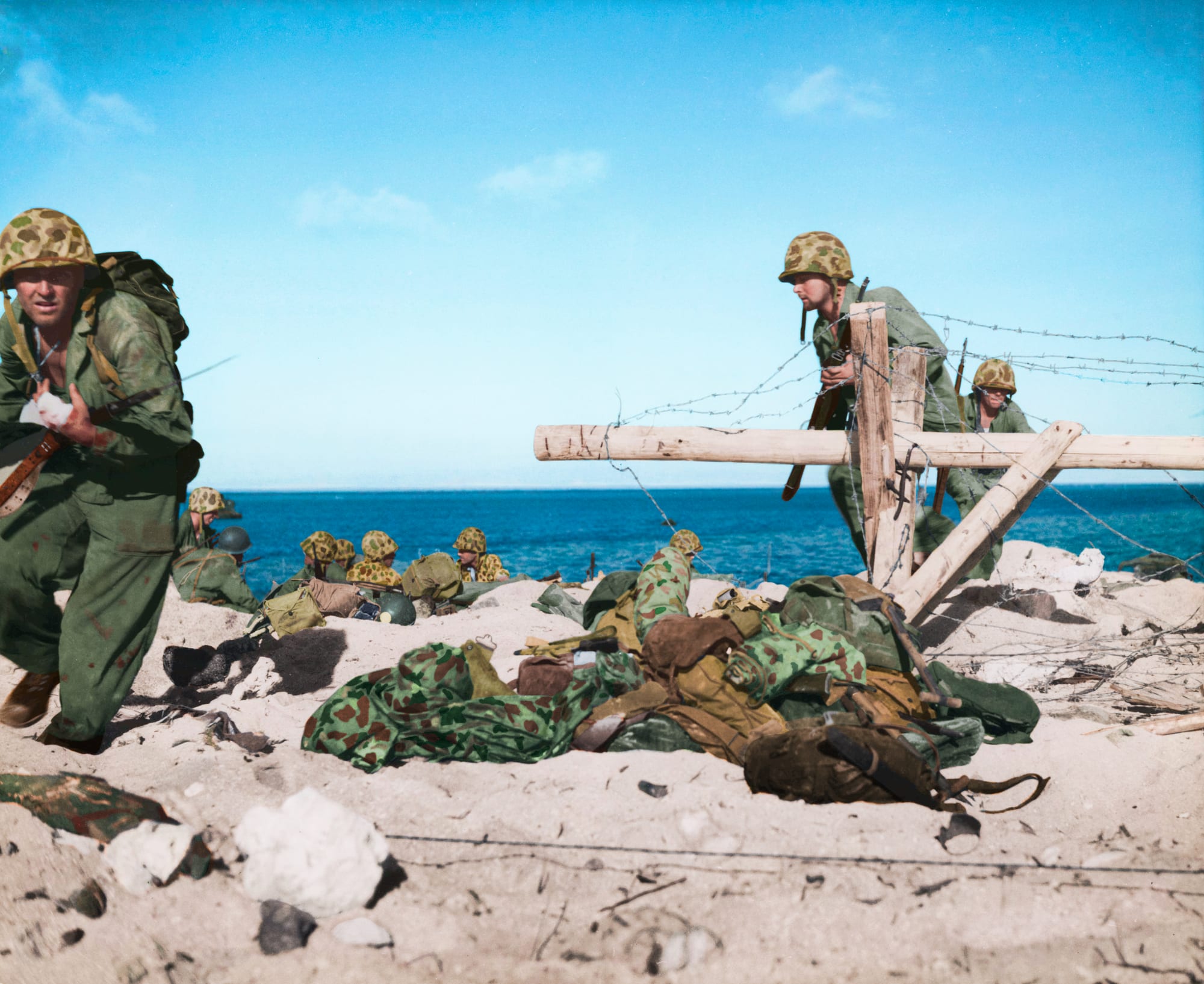
Japan occupied the Gilberts in 1941. In November 1943, US Marines took the tiny island of Betio on Tarawa in 76 hours of fighting that killed around 1,000 Americans and 4,700 Japanese and Korean defenders — a shock to the American public and a hard lesson in amphibious assault.
Independence, and the rising sea
The Polynesian Ellice Islanders voted to separate in 1974, becoming Tuvalu. The Gilberts became independent as Kiribati on 12 July 1979 — the same year the phosphate ran out, taking most of the country's export earnings with it. A sovereign wealth fund built from phosphate royalties has been the financial mainstay ever since, alongside fishing-licence fees from foreign tuna fleets and remittances from I-Kiribati seafarers.
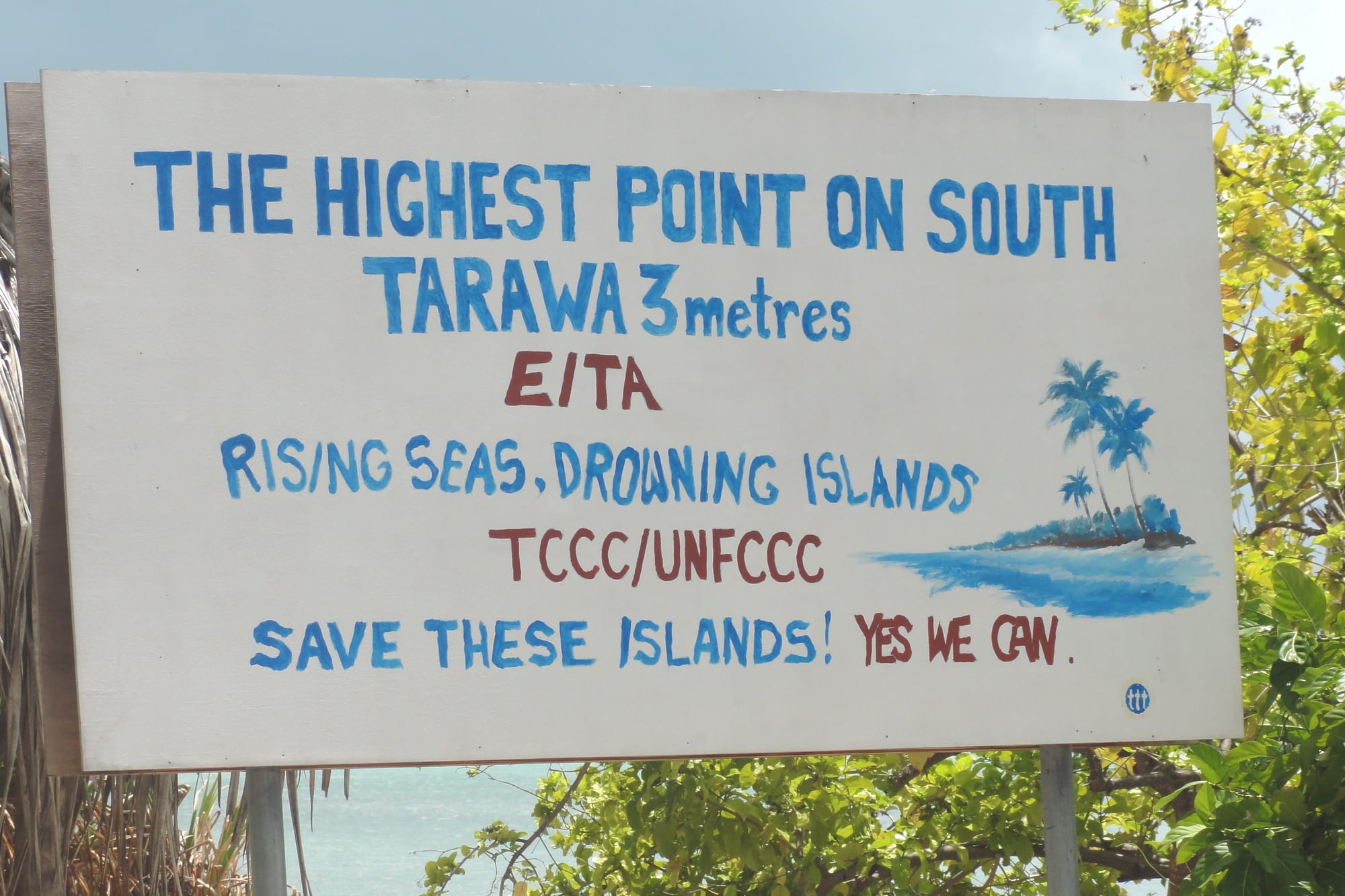
A former president, Anote Tong, made Kiribati a leading voice on climate change and bought land in Fiji as a food-security hedge and possible refuge. His successor switched recognition from Taiwan to China in 2019.
What Kiribati carries
Kiribati's history is a small, remote society repeatedly acted upon from outside — raided for labour, mined for phosphate, fought over in 1943, tested on in the 1950s. Independence came with the loss of the one resource the colonial economy had run on. Now the country faces a threat it did nothing to cause: an ocean that, on land this low, leaves very little margin.