Attractions & Natural Wonders · Iceland
Iceland: Twelve Attractions and Natural Wonders
A young volcanic island on the mid-Atlantic rift — geysers and lava fields, glacier lagoons full of icebergs, black beaches, and waterfalls at nearly every turn of the ring road
By Worldlore Editorial · 9 September 2026
Fire, ice, and a ring road
Iceland is a large volcanic island in the North Atlantic, straddling the boundary between the North American and Eurasian tectonic plates, which is why it keeps erupting and steaming. It has only about 390,000 people, two-thirds of them in the Reykjavík area, and almost the entire interior is uninhabited highland, ice cap, and desert. A single paved highway, the Ring Road (Route 1), loops the coast in about 1,330 kilometres and strings together most of the sights.
The twelve below run clockwise from Reykjavík and the Golden Circle around the south and north. Summer (June to August) has near-endless daylight and open highland roads; winter is dark and stormy but brings the northern lights, and spring and autumn are the quiet shoulder.
1. Reykjavík
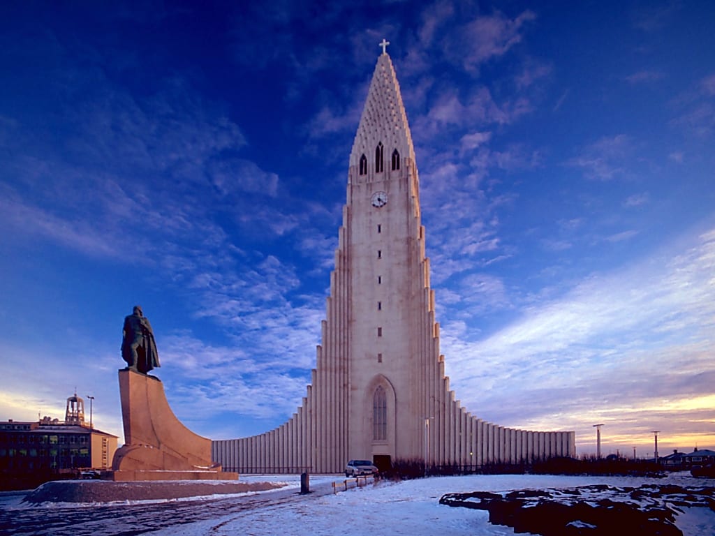
Reykjavík, the world's northernmost capital, is a small, walkable city of corrugated-iron houses in bright colours, strong coffee, live music, and hot outdoor pools in every neighbourhood. Climb the tower of Hallgrímskirkja for the view, walk the harbour and the mirrored Harpa concert hall, see the Settlement Exhibition built around a Viking longhouse, and eat a lamb hot dog at Bæjarins Beztu.
It is the base for almost every trip and has most of the country's nightlife and restaurants.
2. Þingvellir
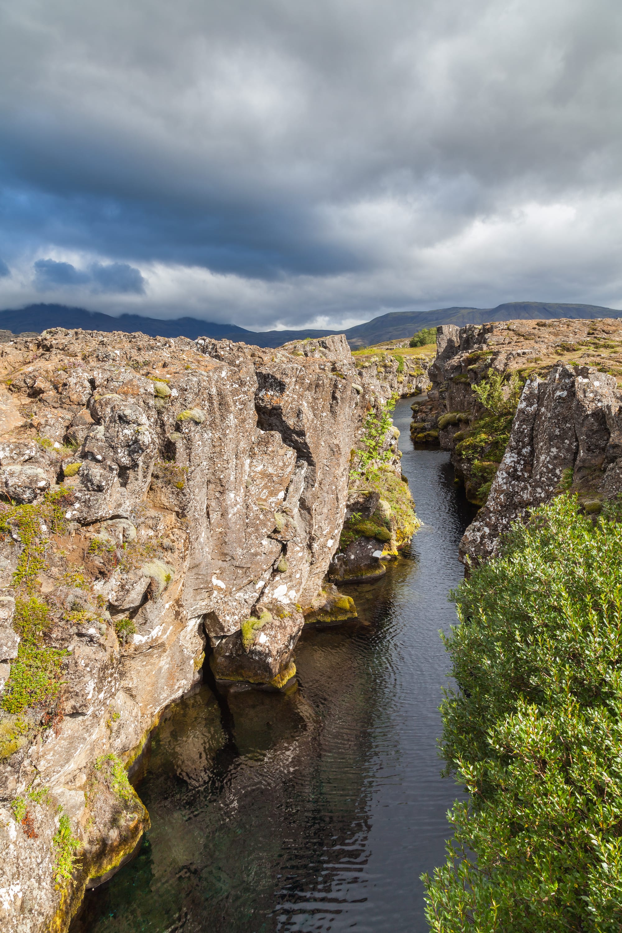
Þingvellir, the first stop on the "Golden Circle", is where Iceland's chieftains founded one of the world's oldest parliaments, the Alþingi, in AD 930, and it is also a place where the mid-Atlantic rift comes to the surface — you walk through a canyon between the diverging plates. The clear, cold Silfra fissure nearby is a famous snorkelling and diving site. It is a UNESCO World Heritage Site.
It is about 45 minutes from Reykjavík.
3. Geysir and Strokkur
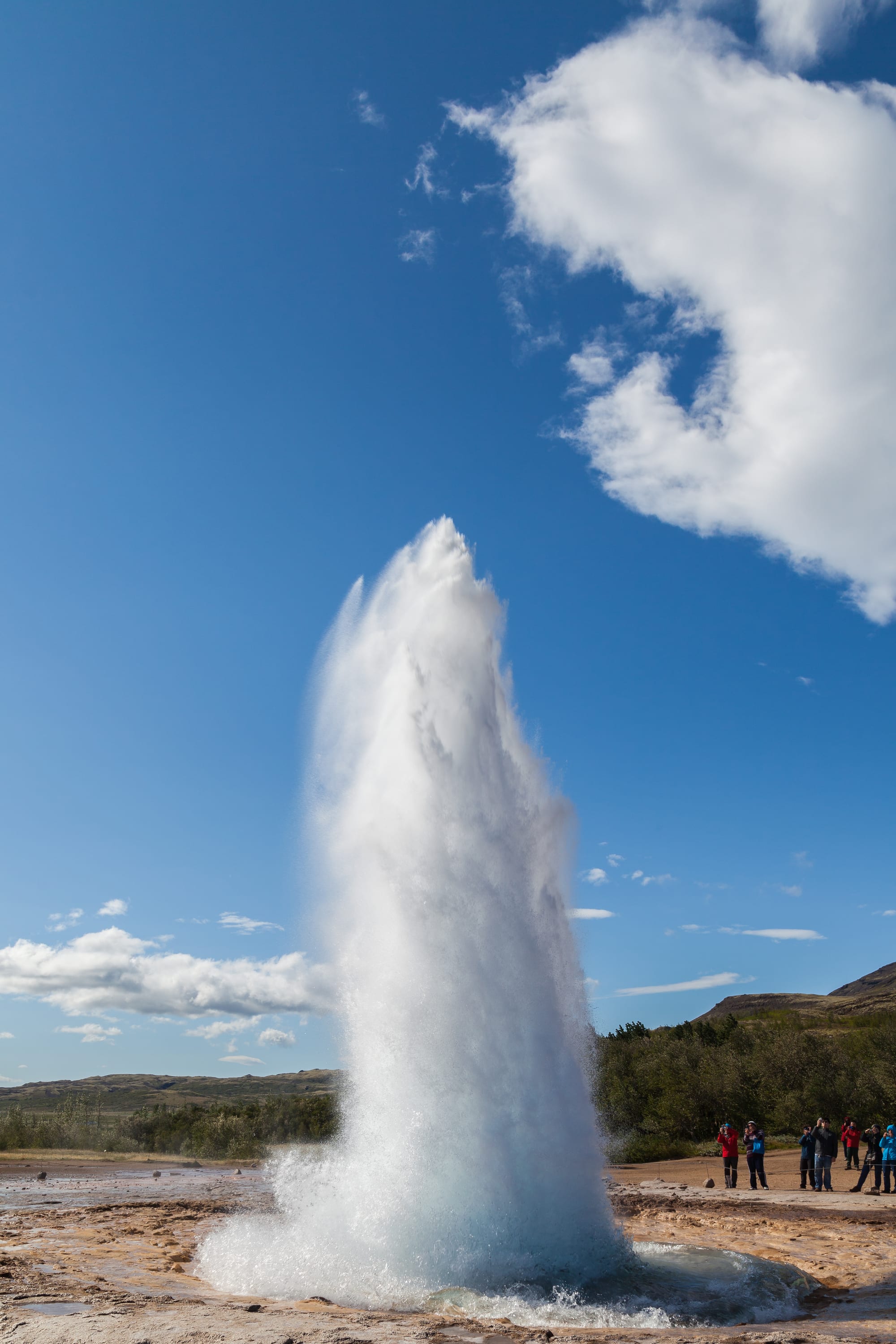
The Haukadalur valley gave the world the word "geyser", from the Great Geysir, now mostly dormant. Its neighbour Strokkur takes over the show, firing a column of boiling water 15–20 metres into the air every 6–10 minutes, surrounded by bubbling blue pools and steaming ground.
It is the middle stop of the Golden Circle, a few minutes' drive from Gullfoss.
4. Gullfoss
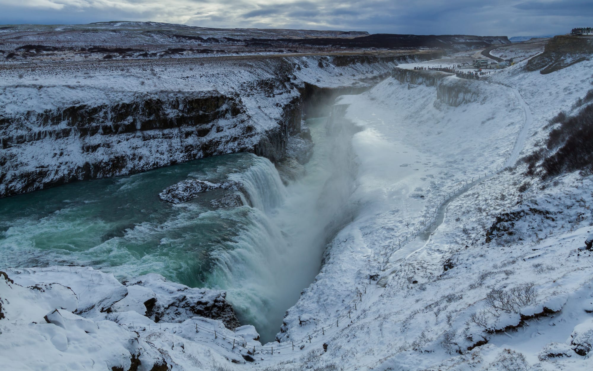
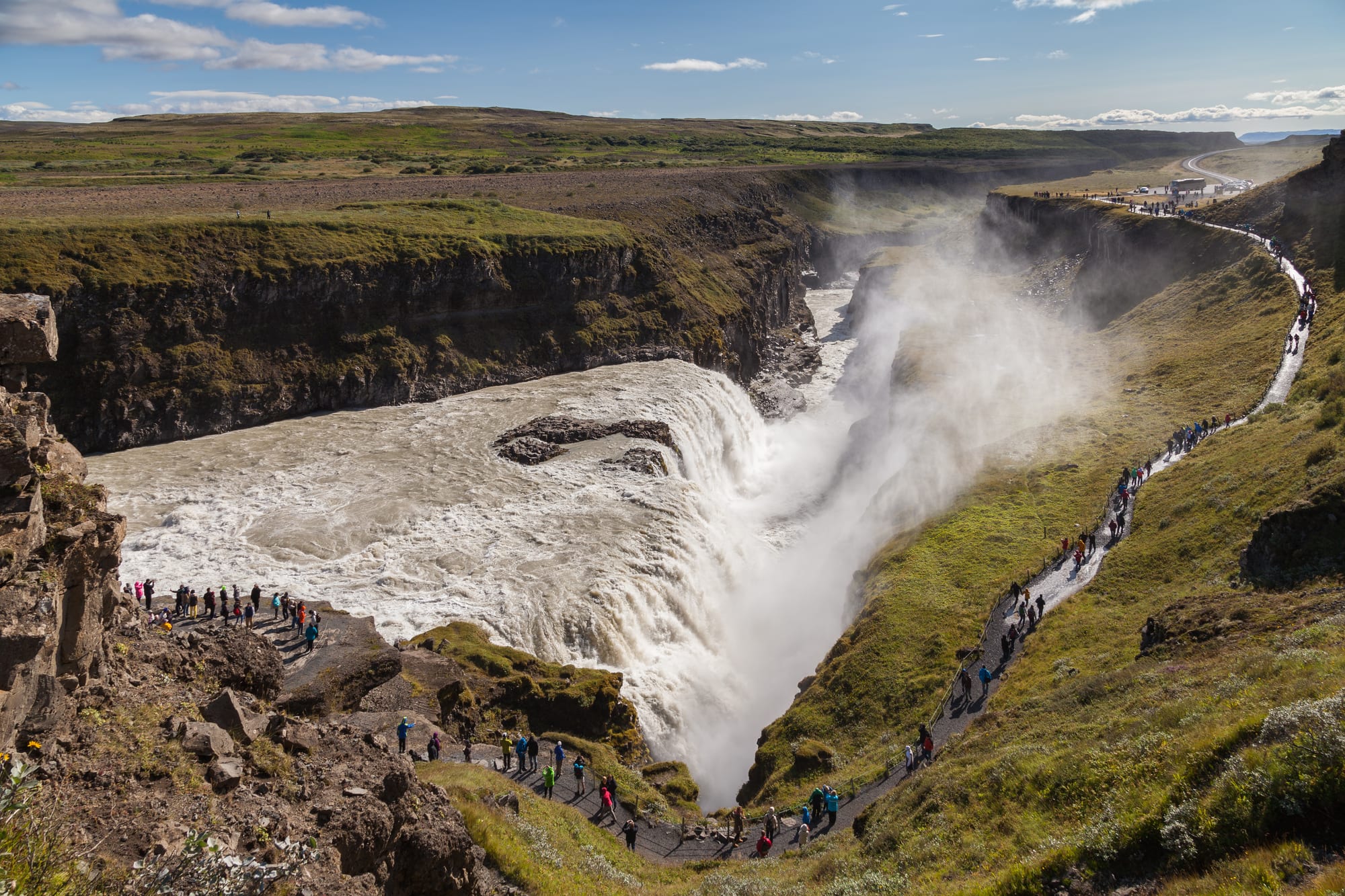
Gullfoss, the third stop on the Golden Circle, is where the glacial Hvítá river tumbles in two big steps and then swings 90 degrees into a narrow, 32-metre-deep canyon, throwing spray and rainbows. A campaign in the early 20th century, led by farmer's daughter Sigríður Tómasdóttir, saved it from a hydroelectric scheme.
Paths run along the rim and down toward the lip; they can be icy in winter.
5. The Blue Lagoon and Reykjanes
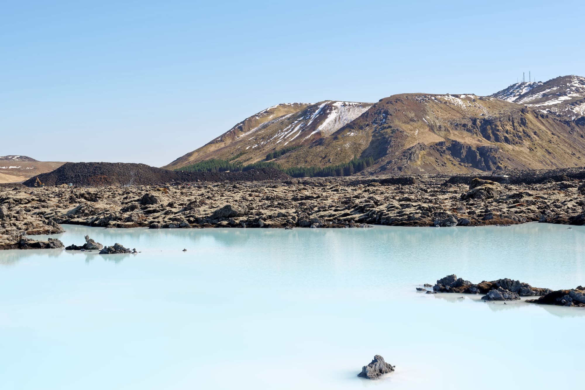
The Blue Lagoon, a milky-blue pool of silica-rich water fed by a geothermal power plant, sits in a black lava field 20 minutes from the airport — the classic first or last stop of an Iceland trip (book well ahead). The wider Reykjanes peninsula is a UNESCO Global Geopark of steaming vents, the "Bridge Between Continents", and, since 2021, repeated volcanic eruptions near Grindavík.
Volcanic activity sometimes closes roads and the lagoon itself; check status before travelling.
6. The south-coast waterfalls
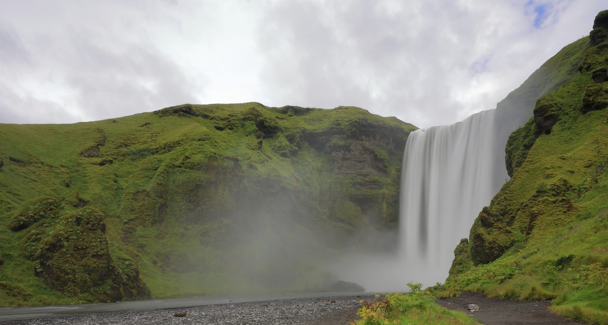
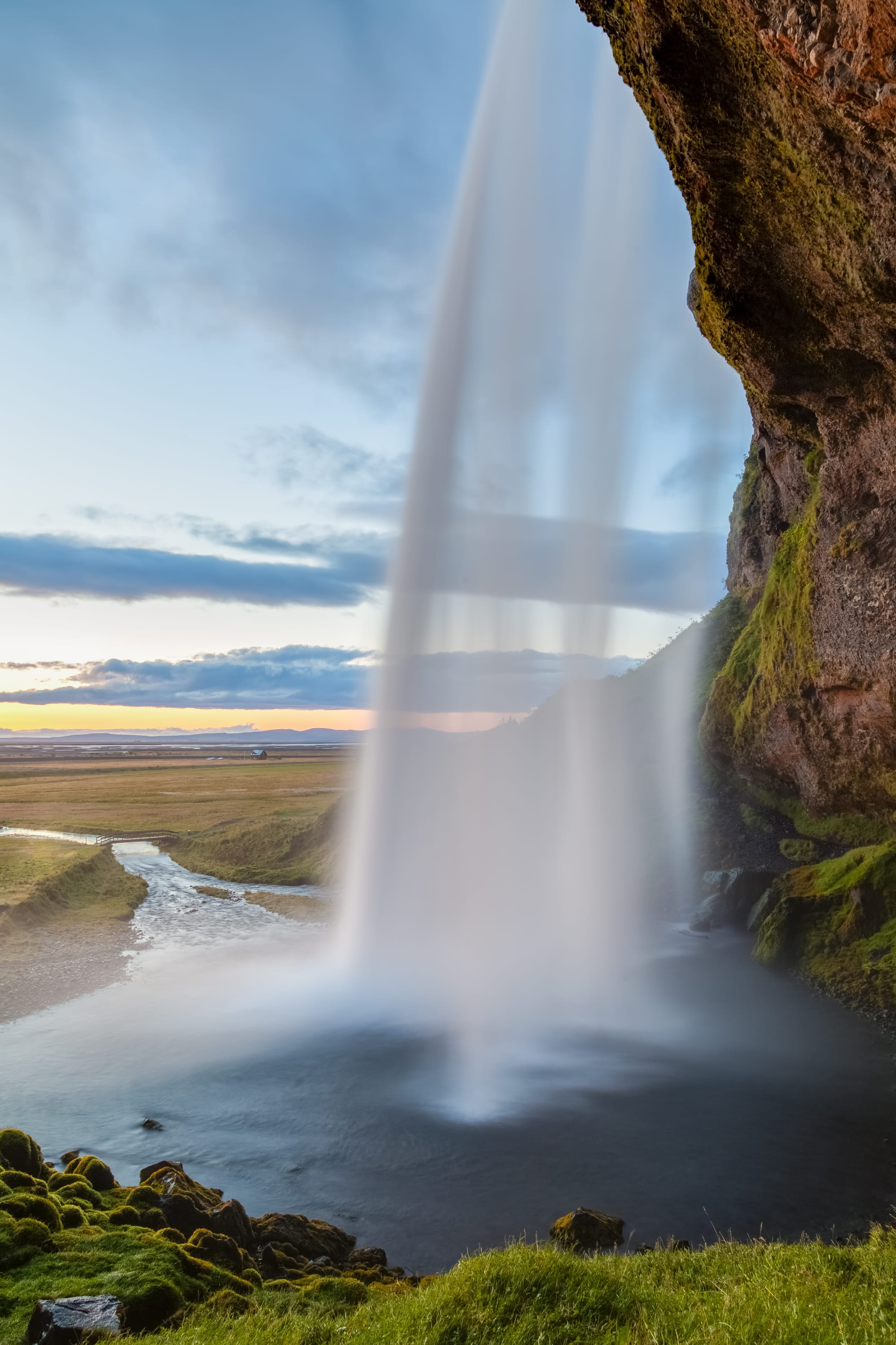
The south coast between Selfoss and Vík is a run of famous falls dropping off the old coastline. Seljalandsfoss has a path that leads behind the water; Skógafoss is a broad, thundering curtain with a stairway to a clifftop viewpoint and the start of a spectacular multi-day trail up to Þórsmörk; and the hidden Gljúfrabúi sits in a slot canyon nearby.
They are strung along the Ring Road, an easy day from Reykjavík or a stop en route east.
7. Reynisfjara and Vík
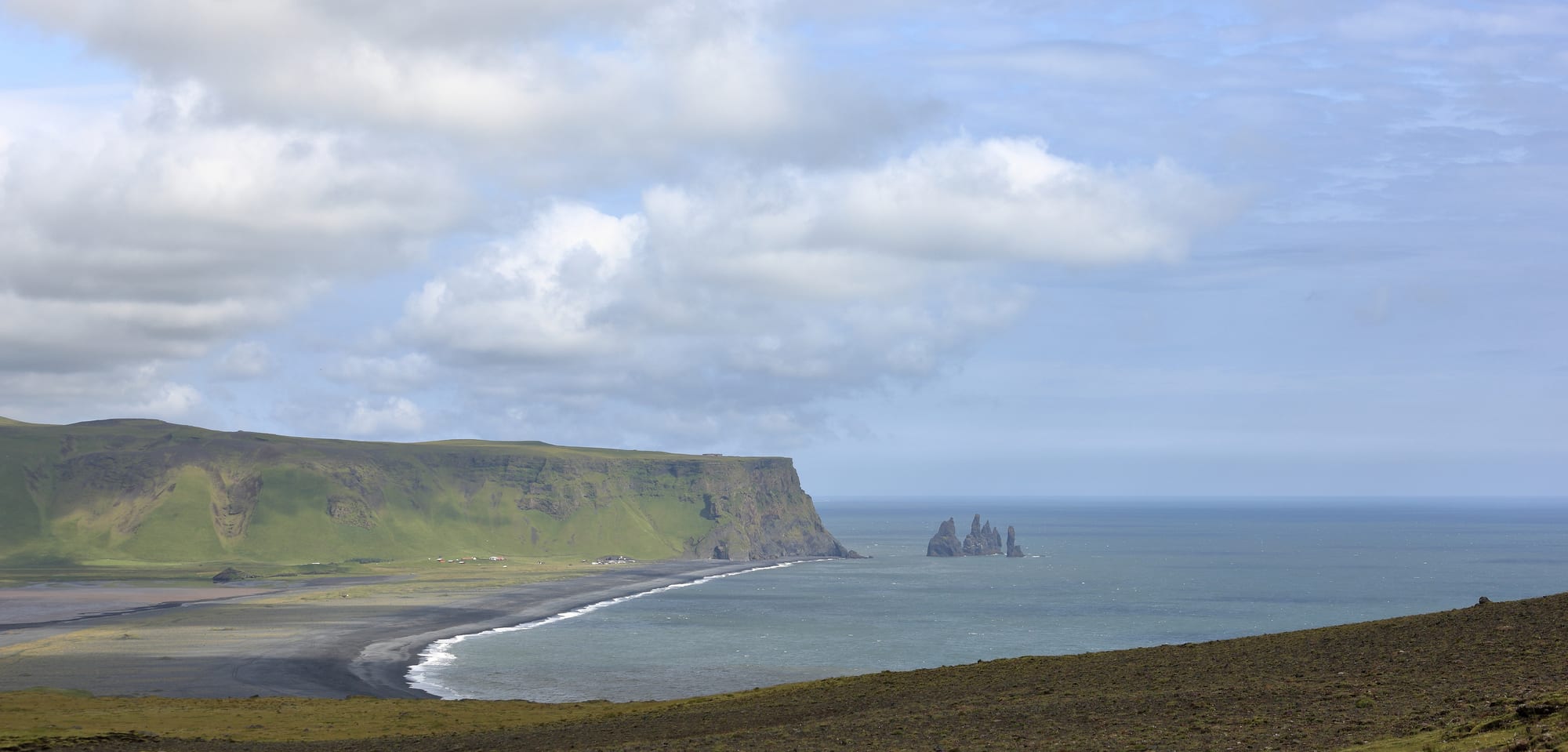
Reynisfjara, near the village of Vík, is the best known of Iceland's black volcanic beaches — jet-black sand, a cave of hexagonal basalt columns, puffins on the cliffs in summer, and the pointed Reynisdrangar stacks offshore. It is also genuinely dangerous: powerful, unpredictable "sneaker waves" have swept people out to sea, so stay well back from the water.
Nearby are the Dyrhólaey arch and the Sólheimajökull glacier tongue for guided ice walks.
8. Jökulsárlón and Vatnajökull
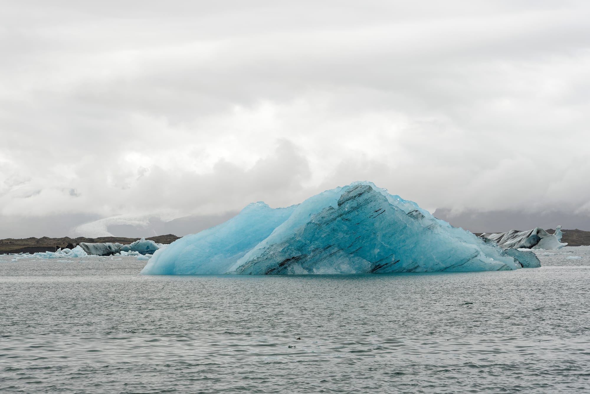
On the southeast coast, Jökulsárlón is a lagoon where icebergs break off the Breiðamerkurjökull glacier and drift toward the sea; boat trips weave among them, and the bergs that wash up on the black sand of nearby "Diamond Beach" are a photographer's staple. Behind it all rises Vatnajökull, the largest ice cap in Europe, covering a UNESCO-listed national park with ice caves (winter), the Skaftafell area, and Iceland's highest peak.
The lagoon is about a 4.5-hour drive from Reykjavík — most people stay a night nearby.
9. Akureyri, Goðafoss, and Lake Mývatn
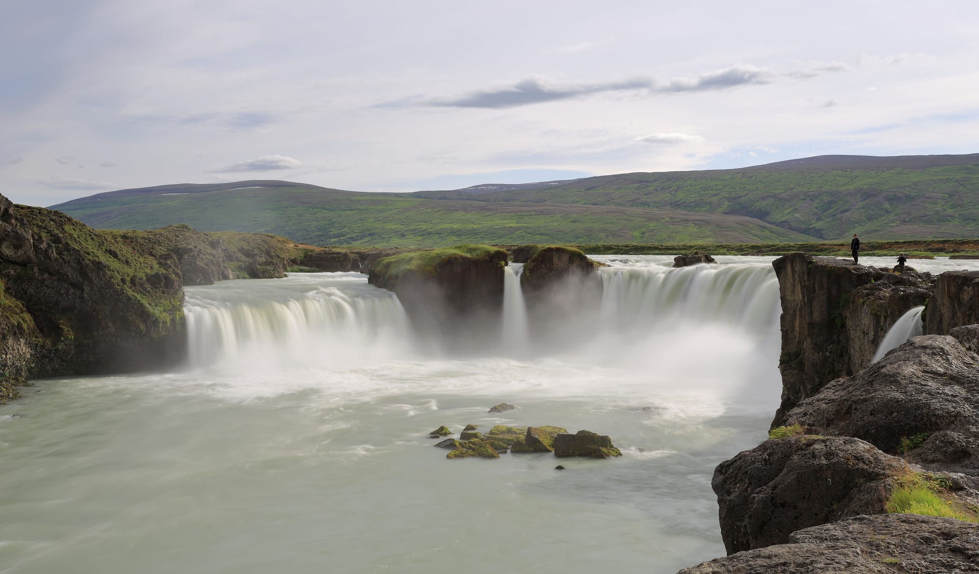
The north has its own circuit. Akureyri, the "capital of the north", is a small city at the head of a long fjord with a botanical garden and good food. Nearby Goðafoss is a graceful horseshoe falls; Lake Mývatn is a shallow, bird-rich lake ringed by pseudo-craters, lava pillars at Dimmuborgir, the bubbling mud of Hverir, and the Mývatn Nature Baths (a quieter Blue Lagoon).
Eyjafjörður is also one of Iceland's best places for whale watching, from Húsavík.
10. Dettifoss and the Diamond Circle
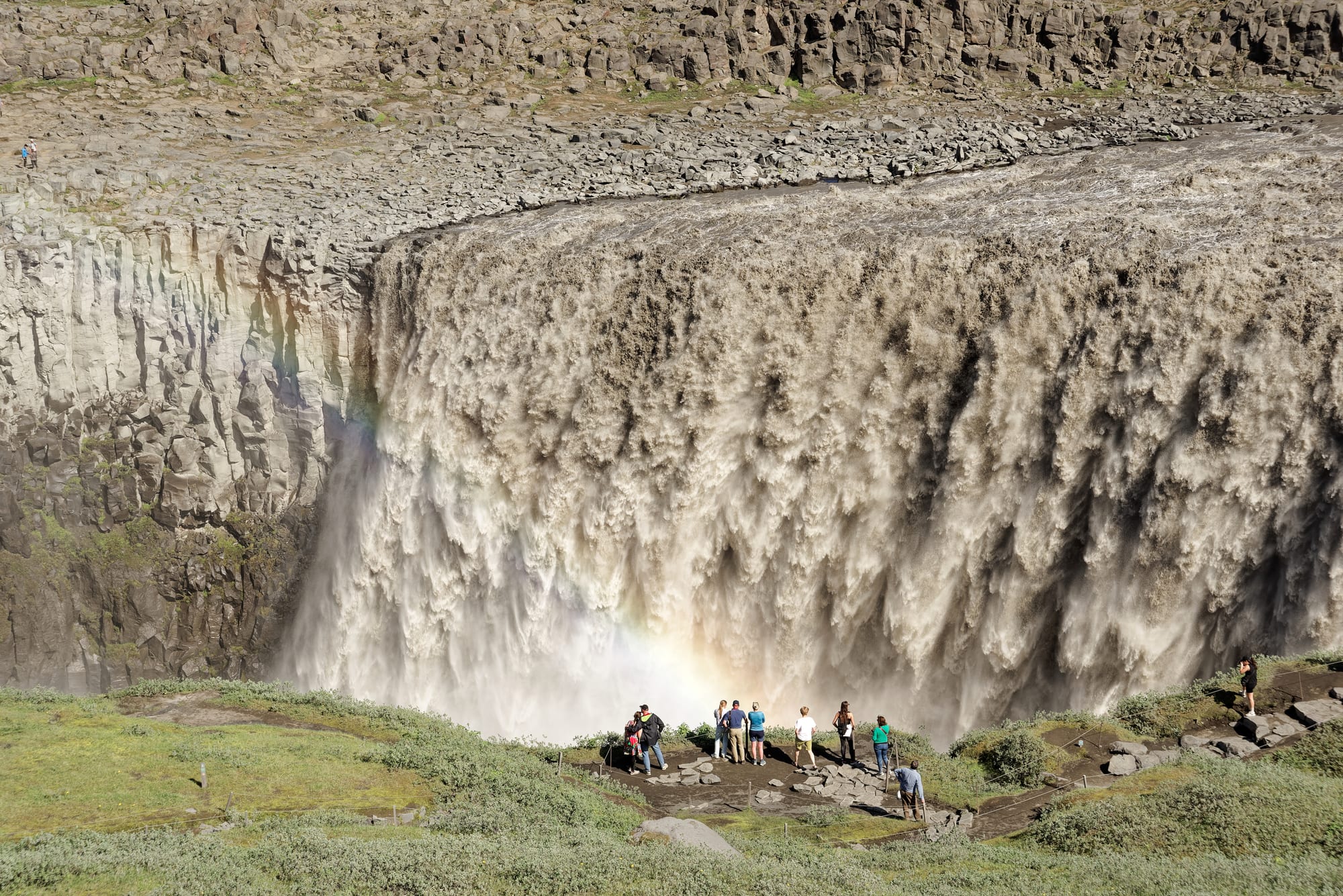
East of Mývatn, the "Diamond Circle" loop takes in Dettifoss — a wall of glacial water 100 metres wide crashing into the Jökulsárgljúfur canyon — along with the horseshoe cliff of Ásbyrgi (said to be a hoofprint of Odin's horse), the red-rimmed Víti crater, and the fishing town of Húsavík.
The road to the west bank of Dettifoss is paved; the east bank is rougher but gives a closer view.
11. Landmannalaugar and the highlands
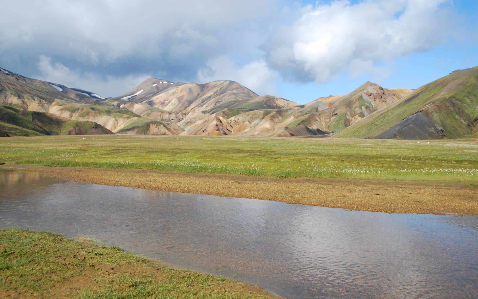
Landmannalaugar, reached only in summer by rough tracks (or a bus), is a geothermal area of rhyolite mountains streaked orange, pink, and green, with a natural hot spring to soak in and hut-to-hut hiking. It is the northern end of the Laugavegur, widely rated one of the world's best multi-day treks, which runs 55 kilometres south to the birch woods of Þórsmörk.
The highland "F-roads" require a 4x4 and river crossings, and open only from roughly late June to September.
12. The Westfjords, Snæfellsnes, and the aurora
Beyond the Ring Road, two peninsulas reward extra time: Snæfellsnes, an easy day or two from Reykjavík, with the Kirkjufell mountain, lava caves, and the glacier that crowns the peninsula; and the remote Westfjords, with the tiered Dynjandi waterfall, the vast Látrabjarg bird cliffs, and the Hornstrandir wilderness. From roughly September to April, on clear dark nights, the northern lights can appear anywhere away from town.
The Westfjords add several days and slower driving; many visitors save them for a second trip.
Iceland is easy to travel but weather-dependent. A short trip (4–5 days) does Reykjavík, the Golden Circle, and the south coast to Jökulsárlón; a full Ring Road circuit needs 8–12 days, and the highlands or Westfjords more still.