Attractions & Natural Wonders · Bolivia
Bolivia: Ten Attractions and Natural Wonders
The world's largest salt flat turned to a mirror, a city that climbs 1,000 metres up a canyon wall, a lake shared with the sky, and the mountain that funded an empire
By Worldlore Editorial · 9 September 2026
The roof of South America
Bolivia is landlocked, high, and culturally the most Indigenous country in the Americas — more than half the population identifies as Aymara, Quechua, or one of 36 recognised peoples. Most of what visitors come for is on the altiplano, the cold, treeless plateau 3,600–4,000 metres up between two branches of the Andes: the salt flat, the lake, the old silver city, and the highland capital. Come prepared for the altitude — acclimatise, go slowly, drink coca tea.
The ten below run from La Paz and Titicaca in the north to Uyuni and the lagoons in the far southwest. September to November and April to early June are the shoulder seasons; the salt flat is a mirror in the wet months (December–March), a white desert the rest of the year.
1. The Salar de Uyuni
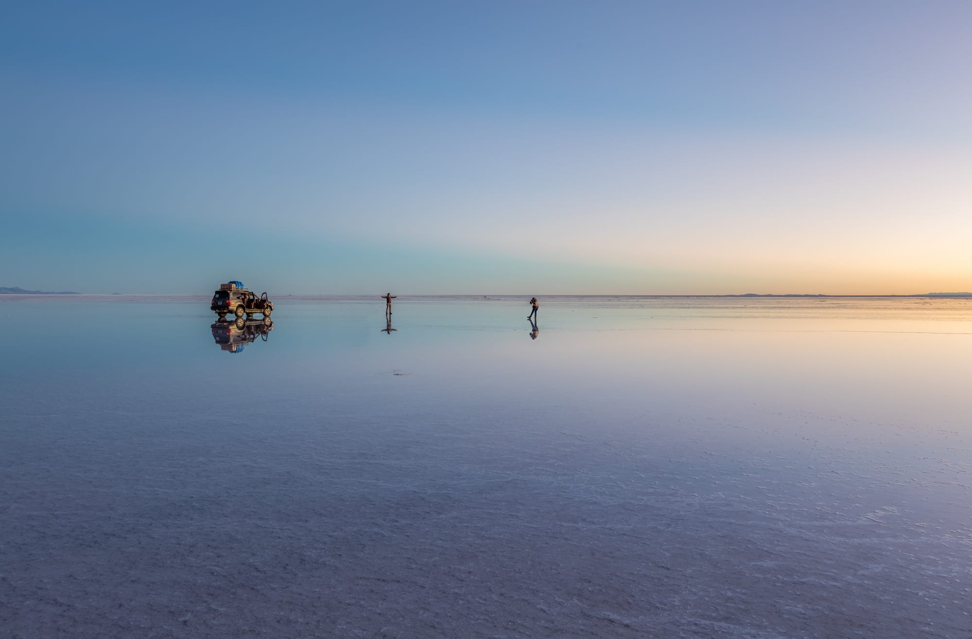
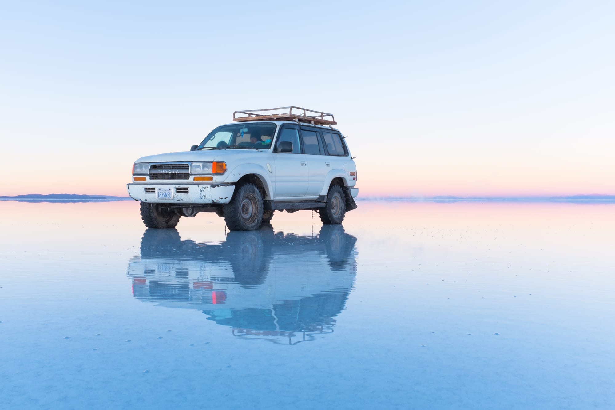
The Salar is the dried bed of a prehistoric lake — a perfectly flat crust of salt several metres thick, so large and featureless that it is used to calibrate satellites. In the dry season it is a blinding white hexagon-patterned plain, crossed by 4x4s to a cactus-covered "island" of coral rock and the old salt hotels; in the wet season a thin layer of water makes it a mirror, and the horizon disappears.
Tours run from the town of Uyuni, from one day to three-day loops that continue into the lagoons. Beneath the surface lies one of the world's largest lithium reserves.
2. The Southwest Circuit and the coloured lagoons
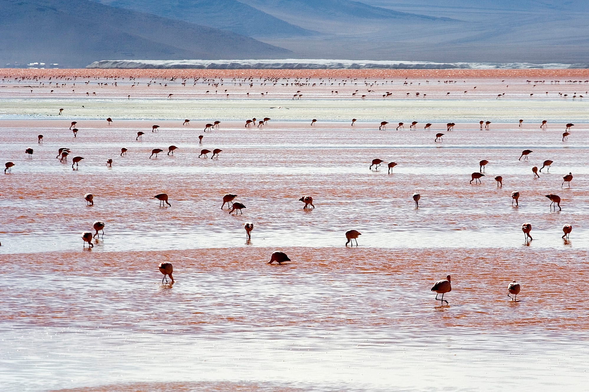
South of the salt flat, the Eduardo Avaroa reserve is a high-altitude desert of mineral lakes, geysers, and volcanoes near the Chilean border. The Laguna Colorada glows rust-red and holds thousands of flamingos of three species; the Laguna Verde turns emerald in the wind below Licancabur volcano; the Sol de Mañana geyser field steams and boils; and there are hot springs to soak in at dawn.
It is cold, remote, and high — most nights on the classic three-day tour are spent above 4,000 metres in basic refuges.
3. La Paz
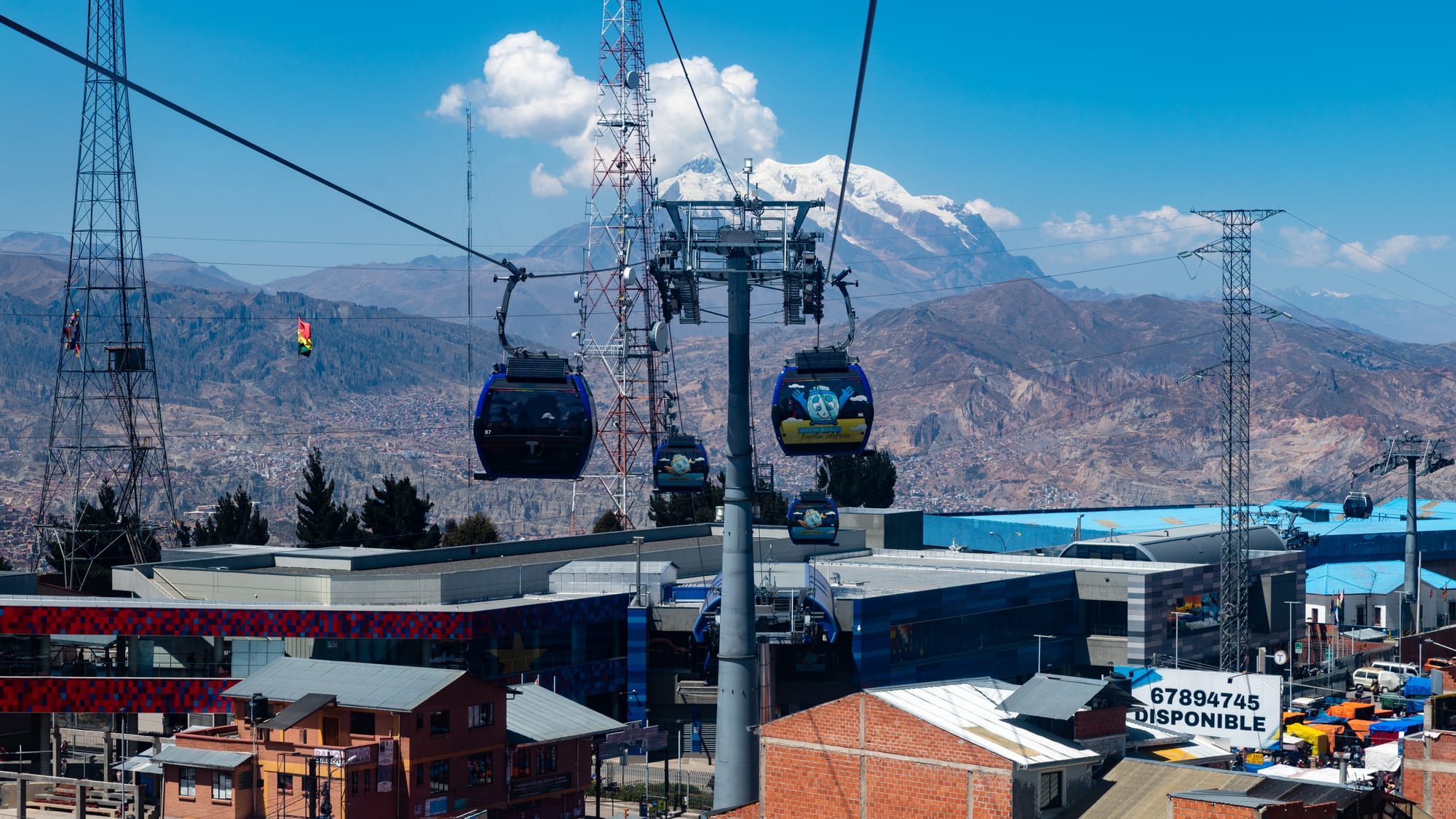
La Paz fills a canyon and spills over its rim, the buildings climbing from about 3,200 metres in the wealthier south to over 4,000 in the vast Aymara city of El Alto on the plateau above. The public transport of choice is a network of colour- coded aerial cable cars, and riding them is the best city tour there is.
At street level: the witches' market with its dried llama foetuses, the colonial core around Plaza Murillo, the San Pedro prison (from the outside), and the adrenaline businesses selling mountain bikes and mountaineering.
4. Lake Titicaca and Isla del Sol
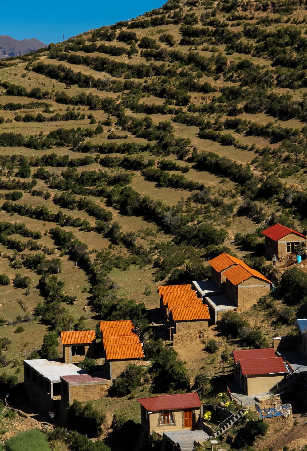
At 3,812 metres, Titicaca is the highest large navigable lake in the world, a deep blue inland sea shared with Peru. On the Bolivian side, the pilgrimage town of Copacabana — with its Moorish-looking basilica and the dark Virgin who is Bolivia's patron — is the base for boats to Isla del Sol, a roadless island of Inca ruins, farming terraces, and hiking trails, where the Inca creation myth places the birth of the sun.
The lake edge is also home to the Uru people, some still living on floating reed islands.
5. Tiwanaku
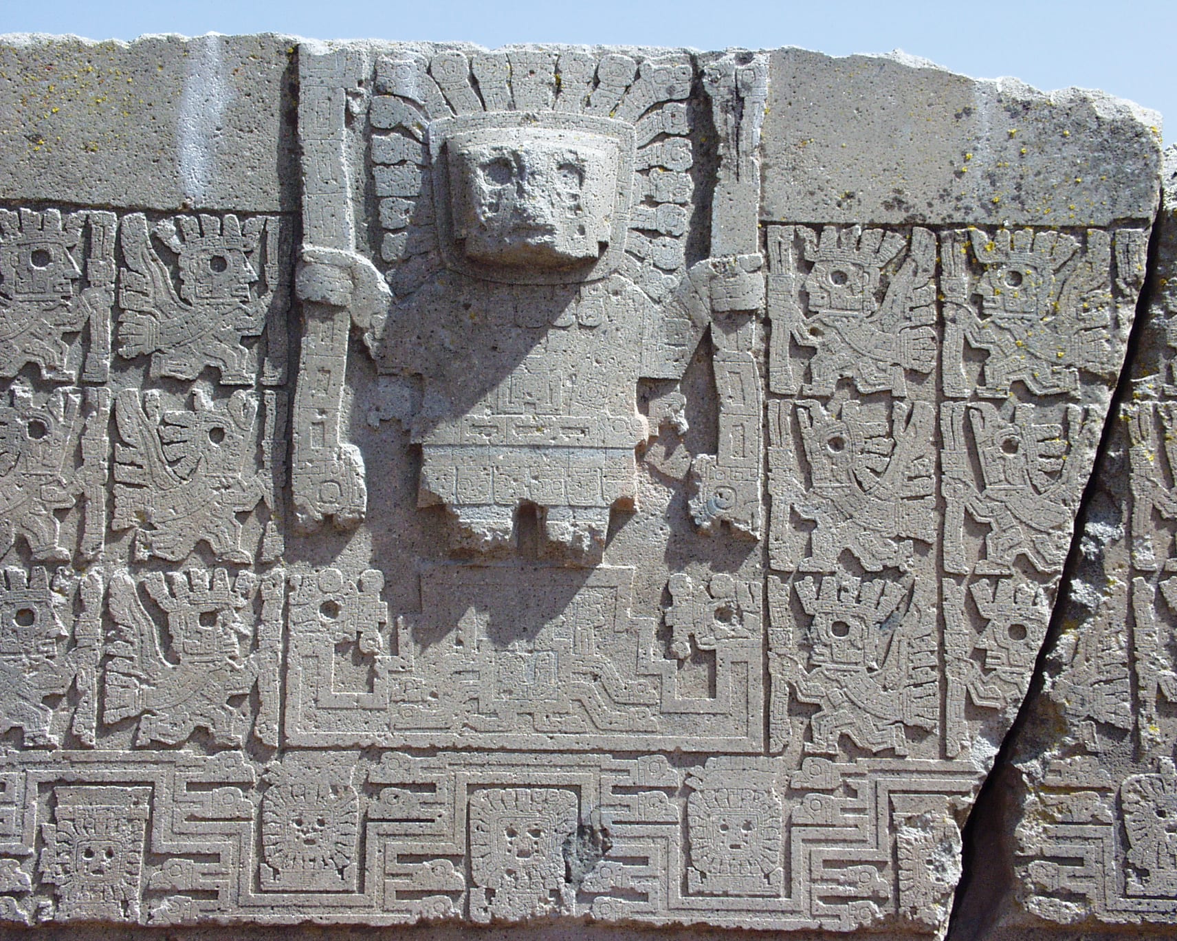
Tiwanaku, an hour from La Paz on the way to the lake, was the capital of an empire that dominated the southern Andes for centuries before the Inca — at its height, around AD 800, a city of tens of thousands. What survives is monumental stonework: the stepped Akapana pyramid, the sunken temple with its wall of carved stone heads, and the Kalasasaya platform with the Gate of the Sun and the Ponce monolith.
It is a UNESCO World Heritage Site with two museums. The techniques used to move and fit the huge stones are still debated.
6. Potosí and the Cerro Rico
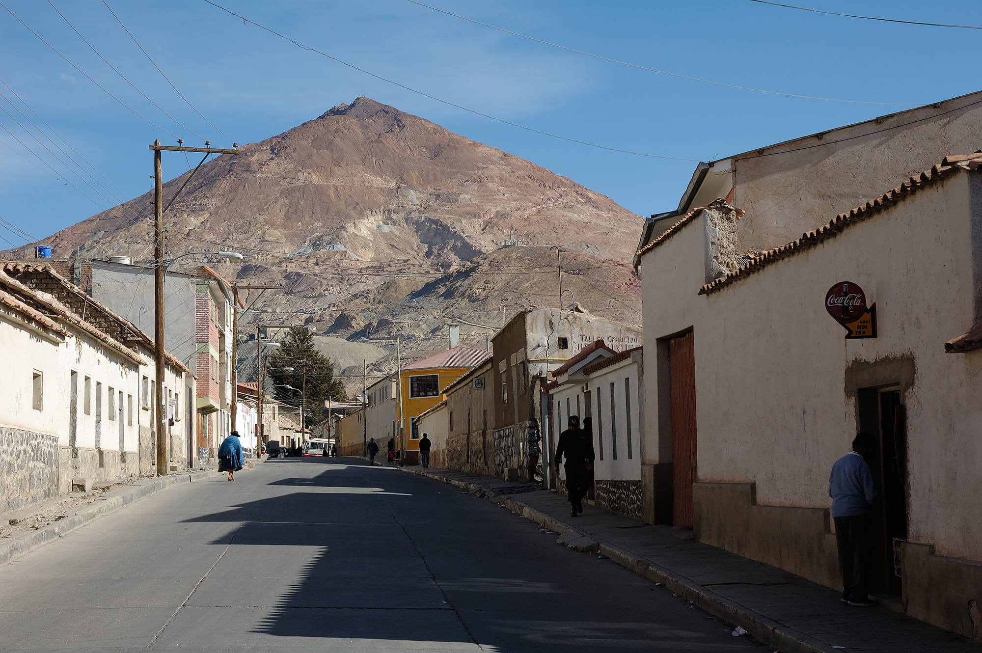
At 4,000 metres, Potosí was for a while one of the largest and richest cities in the world: the silver dug from the Cerro Rico behind it funded Spain for two centuries, at a catastrophic human cost — hundreds of thousands of Indigenous and enslaved African labourers died in the mines. The old city, a UNESCO World Heritage Site, still has its colonial churches, mansions, and the grand Casa de la Moneda mint.
The mountain is still worked by cooperatives in brutal conditions; guided visits into the working tunnels are possible but genuinely uncomfortable and not for everyone.
7. Sucre
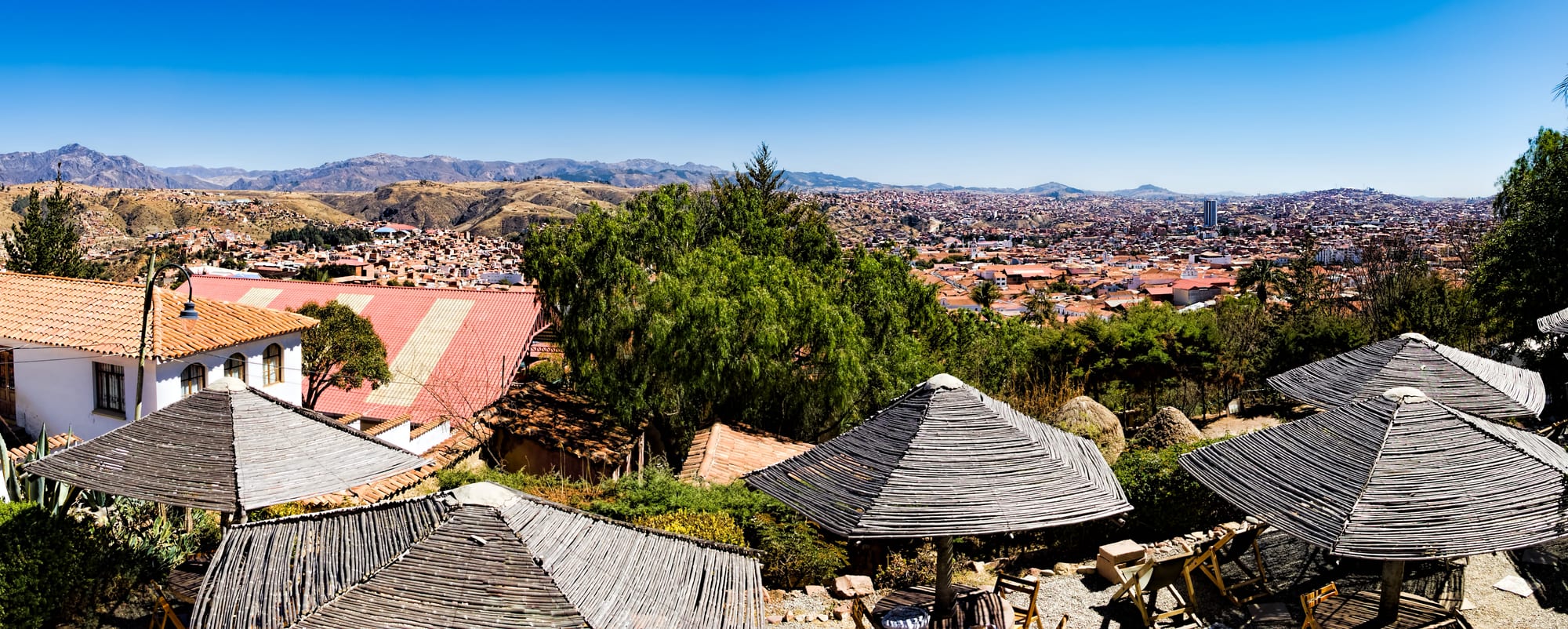
Sucre, lower and warmer than the altiplano at 2,800 metres, is Bolivia's constitutional capital (the seat of the supreme court) and its prettiest city — a UNESCO World Heritage Site of whitewashed buildings, patio courtyards, and Baroque churches, where independence from Spain was declared in 1825.
It is a popular place to study Spanish and to slow down. Just outside town, a near-vertical quarry face preserves thousands of dinosaur footprints, viewable from a walkway.
8. The Yungas 'Death Road'
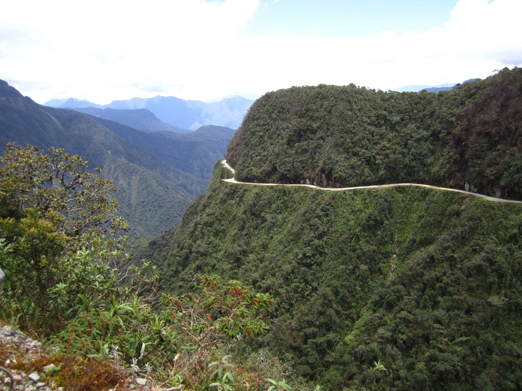
The old road from La Paz to Coroico drops about 3,500 metres in 60-odd kilometres of single-track gravel cut into a cliff, with waterfalls onto the road and long unguarded drops. It once had a fearsome reputation for fatal crashes; since a paved bypass opened in 2006 it carries little traffic and has become a mountain-biking descent, run by many operators out of La Paz.
At the bottom, the town of Coroico is a warm, green place to recover, on the edge of the subtropical Yungas — the gateway to Bolivia's Amazon.
9. The Valle de la Luna
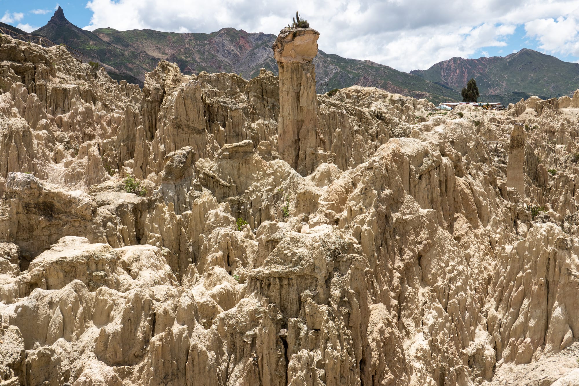
Ten kilometres from central La Paz, where the city meets the canyon rim, wind and rain have eroded a hillside of soft clay and sandstone into a forest of thin spires and ridges. A pair of short marked trails (about 15 and 45 minutes) loop through it, with the snow of Illimani visible beyond.
It is an easy half-day from the city, often combined with the cable car down to the wealthy Zona Sur and the nearby Muela del Diablo rock.
10. The Jesuit Missions of Chiquitos
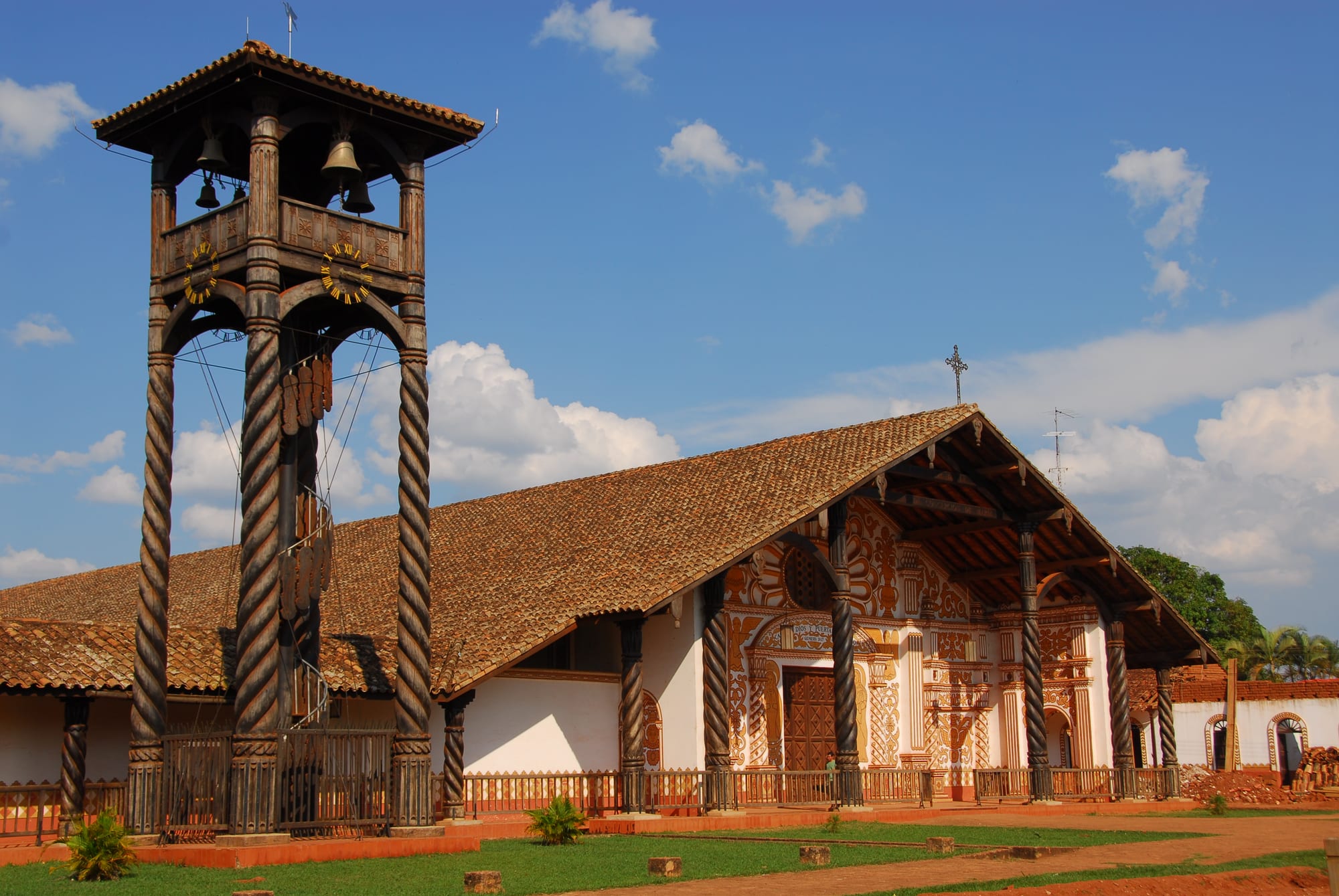
Far from the altiplano, in the hot lowlands of Santa Cruz department, six mission towns preserve an entirely different Bolivia: Baroque churches built by Jesuit missionaries and the Chiquitano people together from the 1690s onward, combining European design with local timber-and-adobe construction and richly carved, painted interiors. Unlike the missions of neighbouring Paraguay and Argentina, these were never destroyed after the Jesuits' 1767 expulsion, and Swiss architect Hans Roth led a decades-long restoration that has left them remarkably intact.
Concepción and San Xavier are the easiest to reach, on a loop road from Santa Cruz; a chamber-music festival held across the missions every two years draws visitors specifically for it. A UNESCO World Heritage Site.
Bolivia takes time and a tolerance for altitude and rough roads. Ten days links La Paz, Titicaca, the salt flat and lagoons, and Sucre or Potosí; the Amazon and the Jesuit missions of the eastern lowlands are a separate trip again.