Attractions & Natural Wonders · Laos
Laos: Nine Attractions and Natural Wonders
A saffron-robed alms procession at dawn, turquoise waterfalls in the jungle, a plain scattered with giant stone jars, and the slow, brown Mekong running through it all
By Worldlore Editorial · 9 September 2026
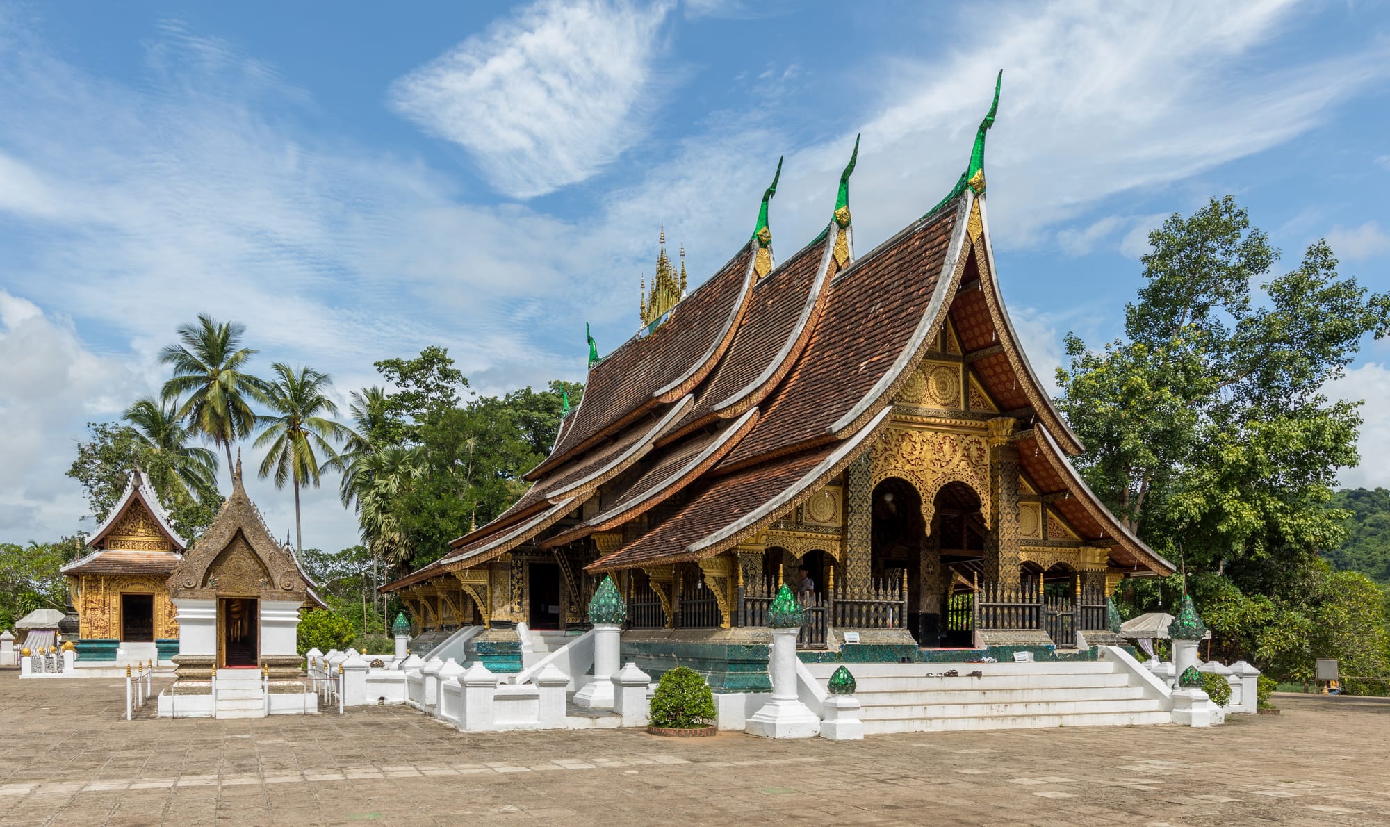
The land of a million elephants
Laos is Southeast Asia's only landlocked country, a long, mountainous, sparsely populated nation strung along the Mekong between Thailand, Vietnam, China, Myanmar, and Cambodia. It has about 7.7 million people, a slow pace of life, a strong Theravada Buddhist culture, and, still, some of the least-developed landscape in the region — forested mountains, few roads, and a Mekong that remains the country's main highway in many places.
The nine below run from the old royal capital in the north down the Mekong to the Cambodian border. The cool, dry season (November to February) is the best time to visit; March–April is hot and hazy from agricultural burning, and the rains run May to October.
1. Luang Prabang
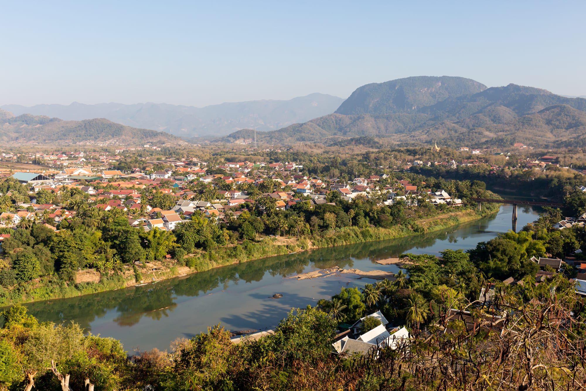
Luang Prabang, the former royal capital, is one of the best-preserved towns in Southeast Asia — a UNESCO World Heritage Site of gilded temples, French colonial shophouses, and saffron-robed monks, set on a peninsula between two rivers. The former Royal Palace (now a museum), the night market, the climb up Mount Phousi for sunset, and a boat trip on the Mekong to the Buddha-filled Pak Ou caves are the essentials.
It has its own small airport and is Laos's undisputed highlight.
2. The tak bat alms procession
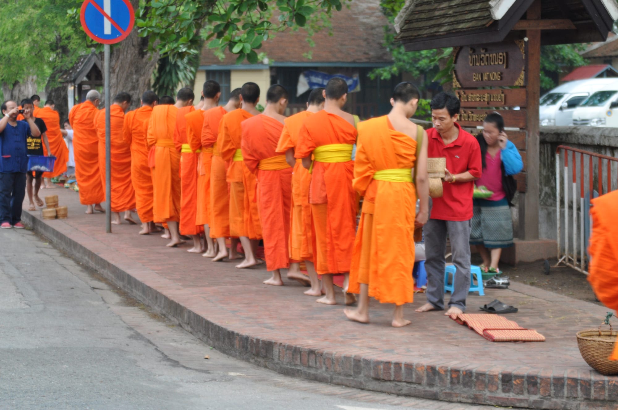
Every morning at first light, hundreds of monks from the town's monasteries walk in single file along the main street to receive rice and food from kneeling residents — an unbroken daily ritual, not a show, though it has become one of Luang Prabang's best-known sights. Guides ask visitors to give quietly if they choose to participate, keep a respectful distance otherwise, and avoid flash photography and tour-bus crowding, which has strained the tradition in recent years.
It begins around 5:30–6am; arrive early and stay unobtrusive.
3. Kuang Si Falls
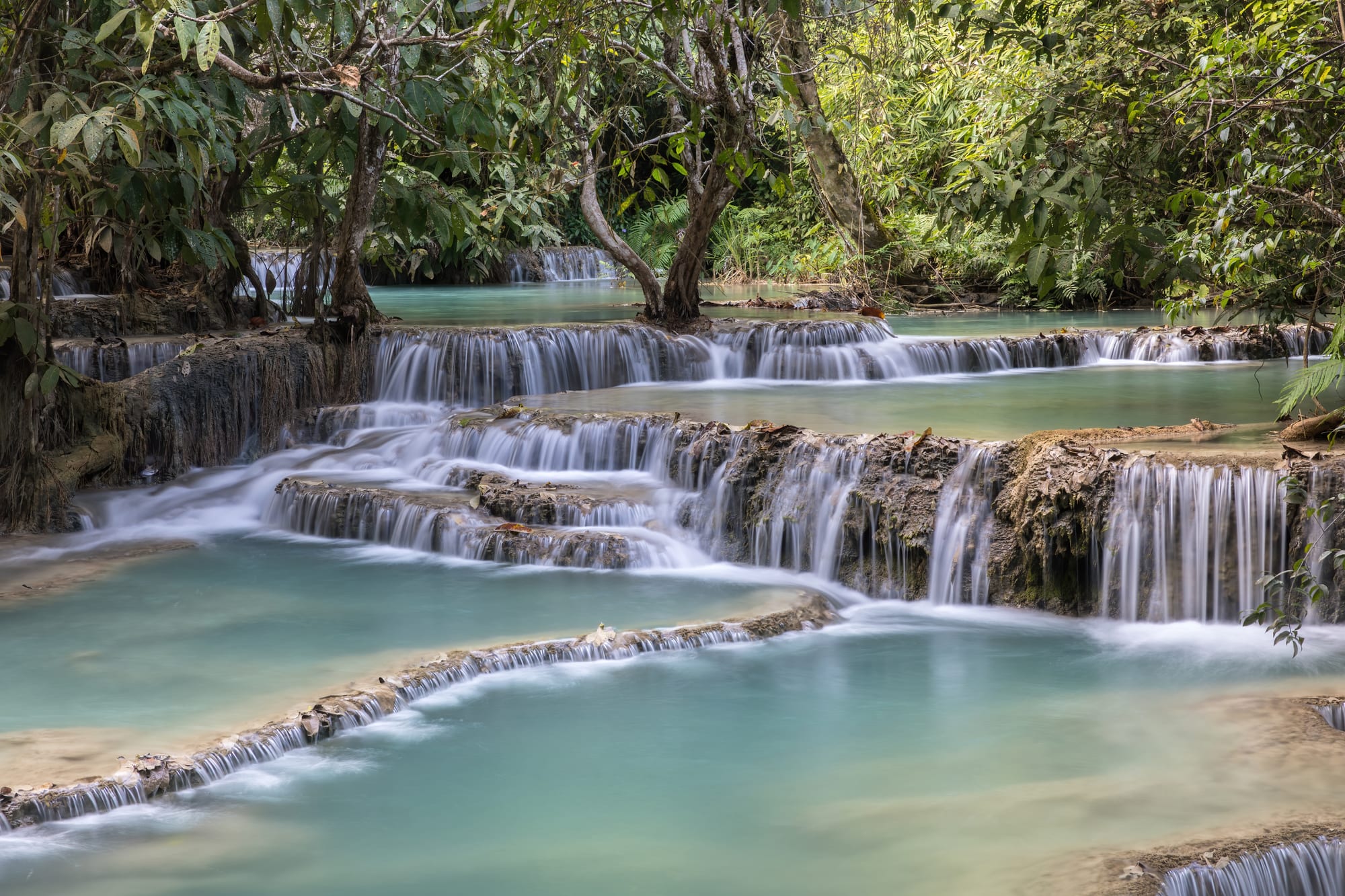
Kuang Si, about 30 kilometres from Luang Prabang, is a multi-tiered limestone waterfall dropping through a series of impossibly turquoise swimming pools in the forest, with a bear rescue sanctuary at the entrance caring for animals confiscated from poachers. It is the classic half-day trip from town, by tuk-tuk or bicycle.
Go early to beat the crowds and the afternoon tour buses.
4. Vientiane and Pha That Luang
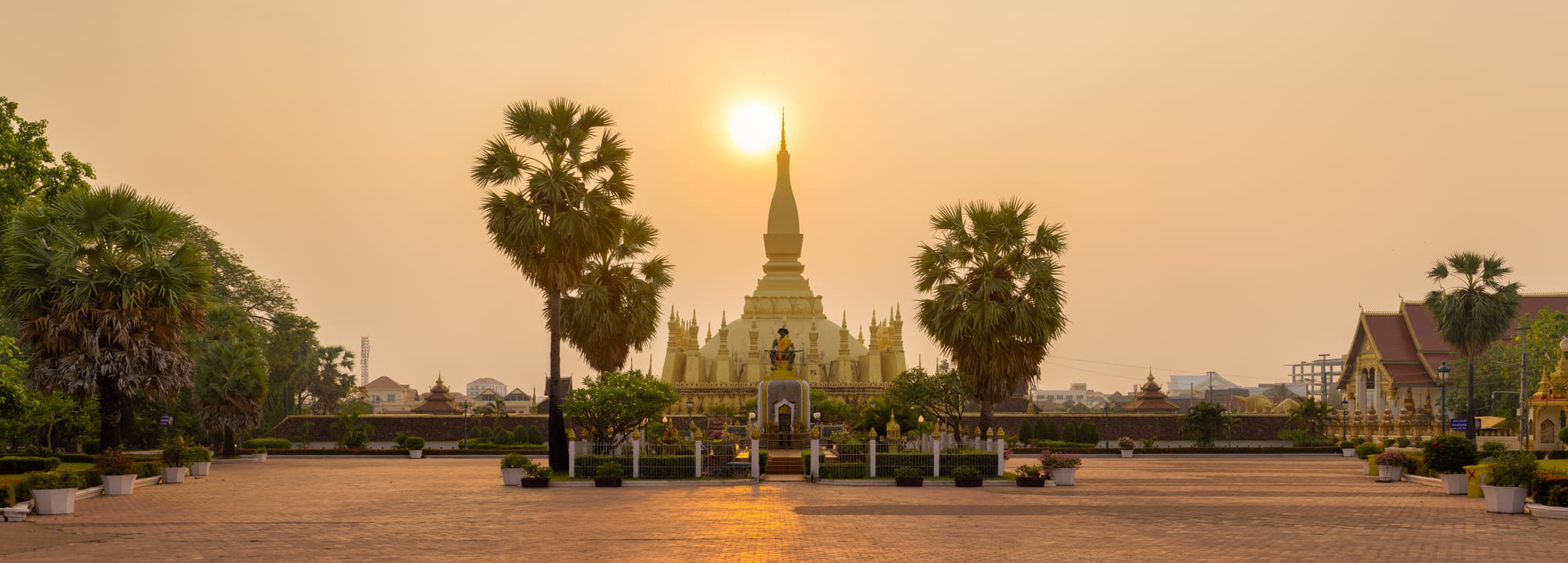
Vientiane, the low-rise, unhurried capital on the Mekong, is easy to underrate — it has none of Luang Prabang's set-piece charm, but its Pha That Luang, a 35-metre gold-covered stupa said to enshrine a relic of the Buddha, is the country's most important monument. Nearby are the temple-turned-museum Wat Sisaket, the Patuxai victory arch, and a growing café and riverside-bar scene along the Mekong.
Most visitors pass through rather than linger, but it rewards a day or two.
5. Vang Vieng
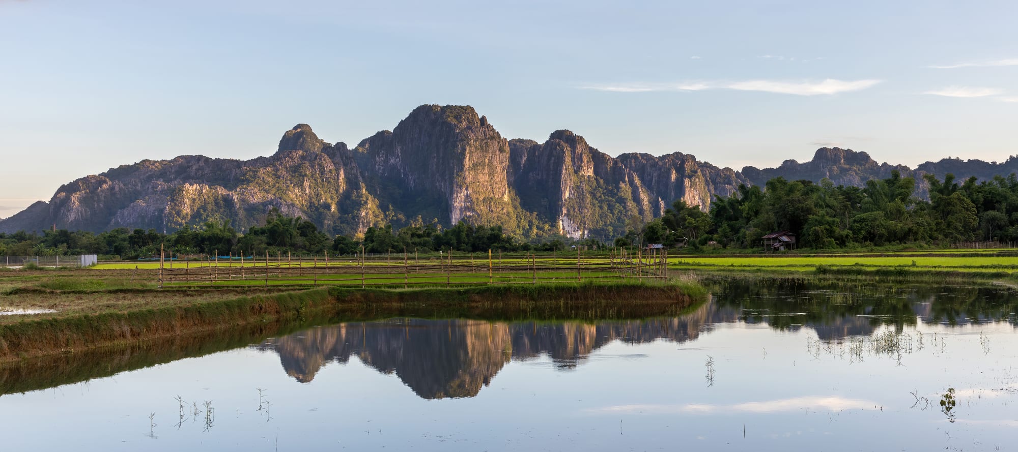
Vang Vieng, between Vientiane and Luang Prabang, sits among dramatic limestone karst towers along the Nam Song river. Once known mainly for a wild tubing and party scene, it has cleaned up and diversified: cave exploring (Tham Chang, Tham Poukham with its "blue lagoon"), hot-air balloon rides over the karst at dawn, hikes up viewpoints like Nam Xay, and kayaking.
It is a popular overnight stop for those doing the Vientiane–Luang Prabang road.
6. The Plain of Jars
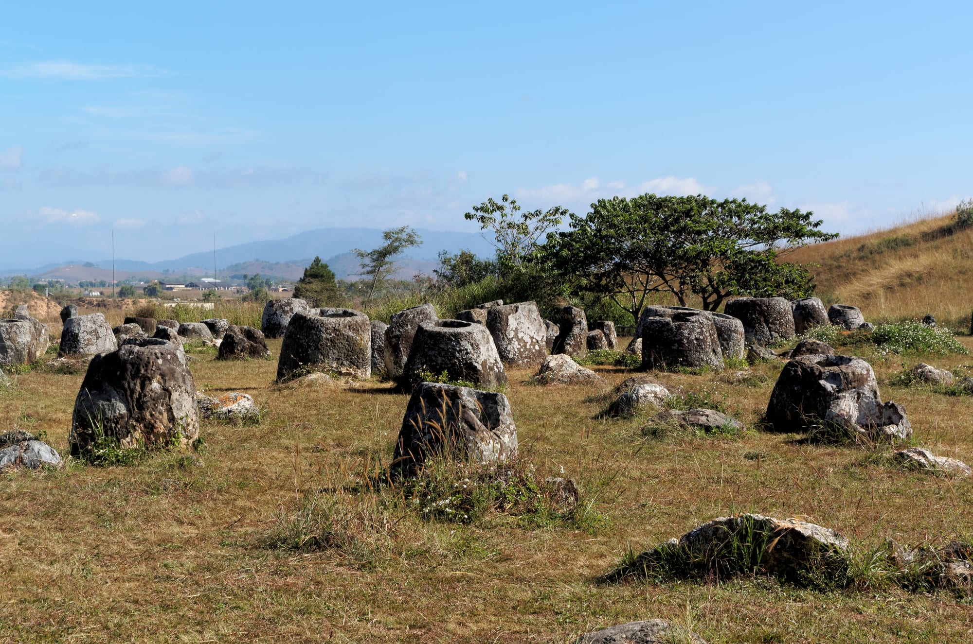
Around Phonsavan in the northeast, thousands of massive carved stone jars — some over 2,000 years old, their purpose still debated (most likely mortuary vessels) — are scattered across dozens of sites, a UNESCO World Heritage Site. The region was also among the most heavily bombed in history during the "Secret War" of the 1960s–70s; craters pit the landscape, and cleared sites are marked with red-and- white MAG (Mines Advisory Group) posts showing where it is safe to walk.
Never step off the marked paths — unexploded ordnance remains a real danger across this whole province.
7. Wat Phou
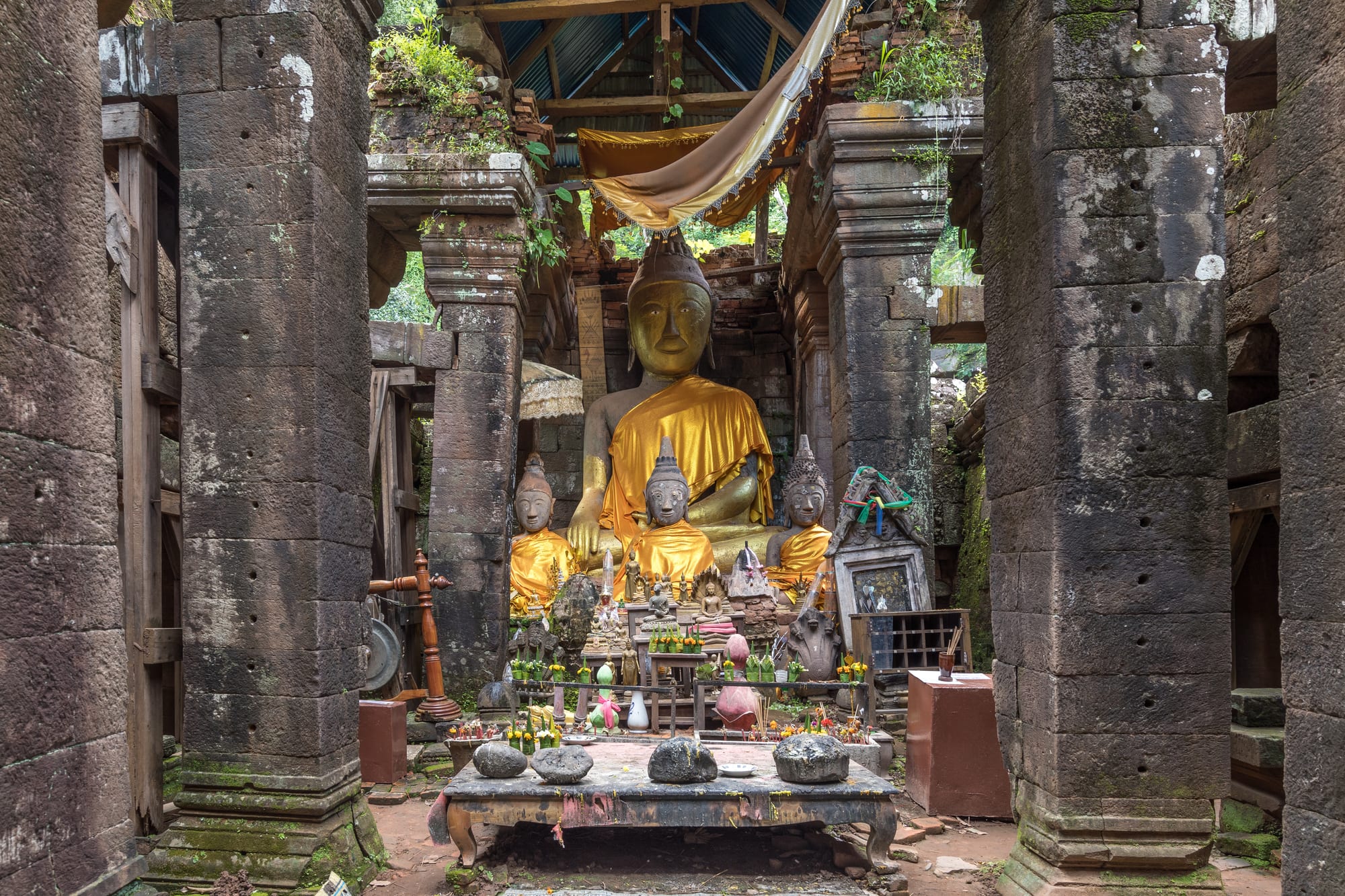
Wat Phou, near Champasak in the far south, is a Khmer temple complex predating Angkor — a stepped sanctuary climbing a hillside to a natural spring shrine, aligned on the same axis principles as the later Cambodian temples. It is a UNESCO World Heritage Site, far quieter than Angkor, and set in a striking riverside landscape.
It is usually visited from Pakse, the main southern city.
8. The Bolaven Plateau
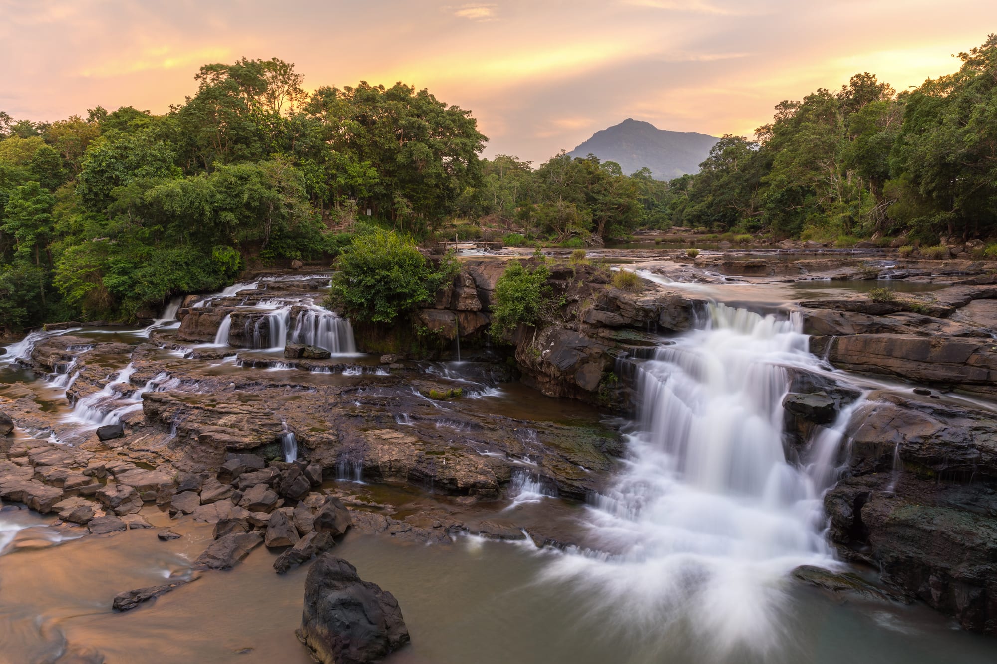
The Bolaven Plateau, above Pakse, is cool volcanic highland known for coffee (Laos's best), waterfalls — Tad Fane, a twin drop into a jungle gorge; Tad Lo; Tad Yuang — and ethnic minority villages. A loop road, the "Bolaven Loop", is a popular motorbike route linking the falls, plantations, and homestays over two or three days.
The plateau's altitude gives relief from the lowland heat.
9. Si Phan Don (Four Thousand Islands)
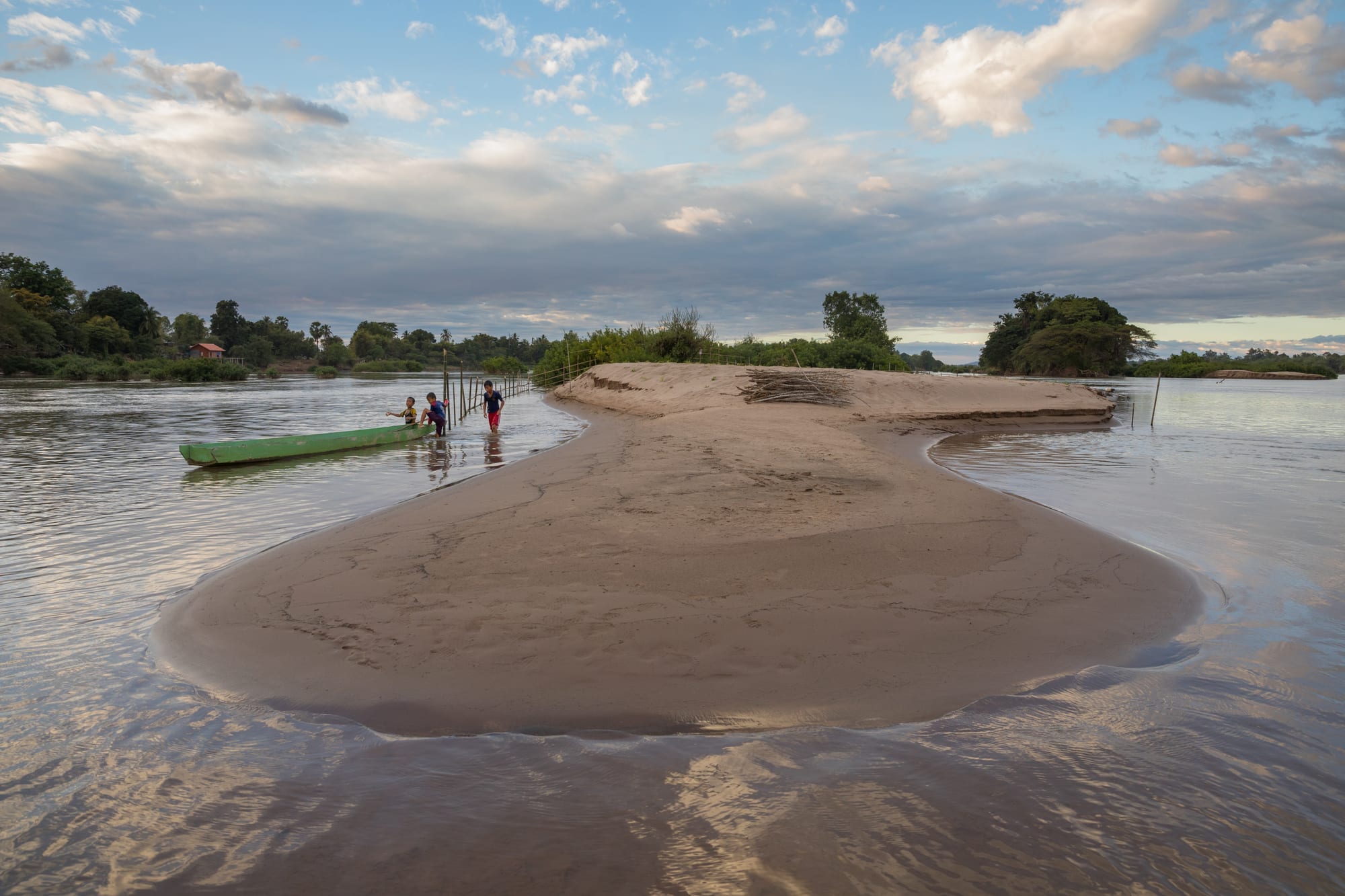
At the southern tip of Laos, the Mekong widens to 14 kilometres and splits around thousands of islands and islets, several inhabited and linked by boat and a few bridges. Don Det and Don Khon are the backpacker bases — hammocks, sunsets, and bicycle rides past the dramatic Khone Phapheng falls, the largest by volume in Southeast Asia — and one of the last refuges of the rare Irrawaddy dolphin.
It is the classic overland crossing point into Cambodia.
Before you go: a practical note
Unexploded ordnance from the 1964–73 bombing campaign remains in the ground across much of eastern and northern Laos, most seriously around the Plain of Jars and the Ho Chi Minh Trail region. Stay strictly on marked paths and roads in rural areas and never touch anything that looks like military hardware. Road travel elsewhere is generally straightforward, though mountain roads are slow and sometimes affected by landslides in the wet season.
A first trip usually links Luang Prabang, Vang Vieng, and Vientiane over 10 days to two weeks; the south (Wat Phou, the Bolaven Plateau, Si Phan Don) is a separate, quieter leg, often combined with onward travel to Cambodia.